Services
Wetland and natural resources services in Oregon
Each project is different. If you're not sure which of these you need, describe your site and plans and we'll help sort it out.
01
Wetland delineations
A delineation identifies the location and extent of wetlands and other waters on a property. It is usually the first step for any project where wet ground, a drainage, or a mapped wetland may be present.
- Preliminary site screening using wetland inventories, soils maps, and aerial imagery
- Field delineation of soils, hydrology, and vegetation
- Sub-meter GPS survey of wetland boundaries and sample plots
- Delineation reports prepared for Oregon DSL concurrence
Typical clients: Developers, engineers, builders, and property owners planning work near wet areas.

02
GIS surveying and mapping
Accurate maps carry a project through agency review. We collect field data with sub-meter GPS and build mapping and analysis in ArcGIS Pro, so boundaries, acreages, and impacts are documented precisely.
- Sub-meter GIS surveying of wetland boundaries, sample plots, streams, and site features
- Mapping and spatial analysis in ArcGIS Pro
- Impact and acreage calculations for permit applications and mitigation plans
- Report figures and map sets for delineations, permits, and Local Wetland Inventories
Typical clients: Developers, engineers, and agencies who need defensible maps and measurements.

03
Removal-fill permit applications
When a project will place fill in, or remove material from, wetlands or waters, it generally needs authorization from Oregon DSL and often from the U.S. Army Corps of Engineers.
- Joint permit applications for DSL removal-fill and Corps Section 404 authorization
- Avoidance and minimization analysis, coordinated with your engineer's site plan
- Responses to agency information requests through permit issuance
Typical clients: Subdivision and commercial developers, public works projects, and road and utility crossings.

04
Wetland and stream functional assessments
Functional assessments describe how well a wetland or stream performs functions such as water storage, water quality, and habitat. Agencies use them to evaluate impacts and size mitigation.
- Hydrogeomorphic (HGM) assessments
- Oregon Rapid Wetland Assessment Protocol (ORWAP)
- Stream Function Assessment Method (SFAM)
Typical clients: Permit applicants and mitigation projects that need impacts and functions documented.

05
Mitigation planning, monitoring, and banking
Most permits that allow wetland impacts require compensatory mitigation, and that mitigation has to be planned, built, and monitored until it meets its performance standards.
- Wetland mitigation plans
- Mitigation site monitoring and monitoring reports
- Wetland mitigation banking
Typical clients: Permit holders, mitigation site owners, and mitigation bank sponsors.

06
Floodplain habitat mitigation assessments
Under FEMA's interim requirements for the National Flood Insurance Program in Oregon, many cities and counties now require a habitat mitigation assessment, prepared by a qualified professional, for proposed development inside the Special Flood Hazard Area (the 100-year floodplain). The assessment has to show that the project will result in no net loss of floodplain habitat functions, with mitigation where impacts can't be avoided.
- Habitat assessments following FEMA's Oregon floodplain habitat assessment and mitigation guidance
- Evaluation of impacts to flood storage, water quality, and riparian vegetation
- Mitigation plans to achieve no net loss
- Documentation for local floodplain development permits
Typical clients: Property owners, builders, and developers planning work in the 100-year floodplain. Requirements and exemptions vary by city and county, so ask us early in planning.

07
Wetland and riparian inventories
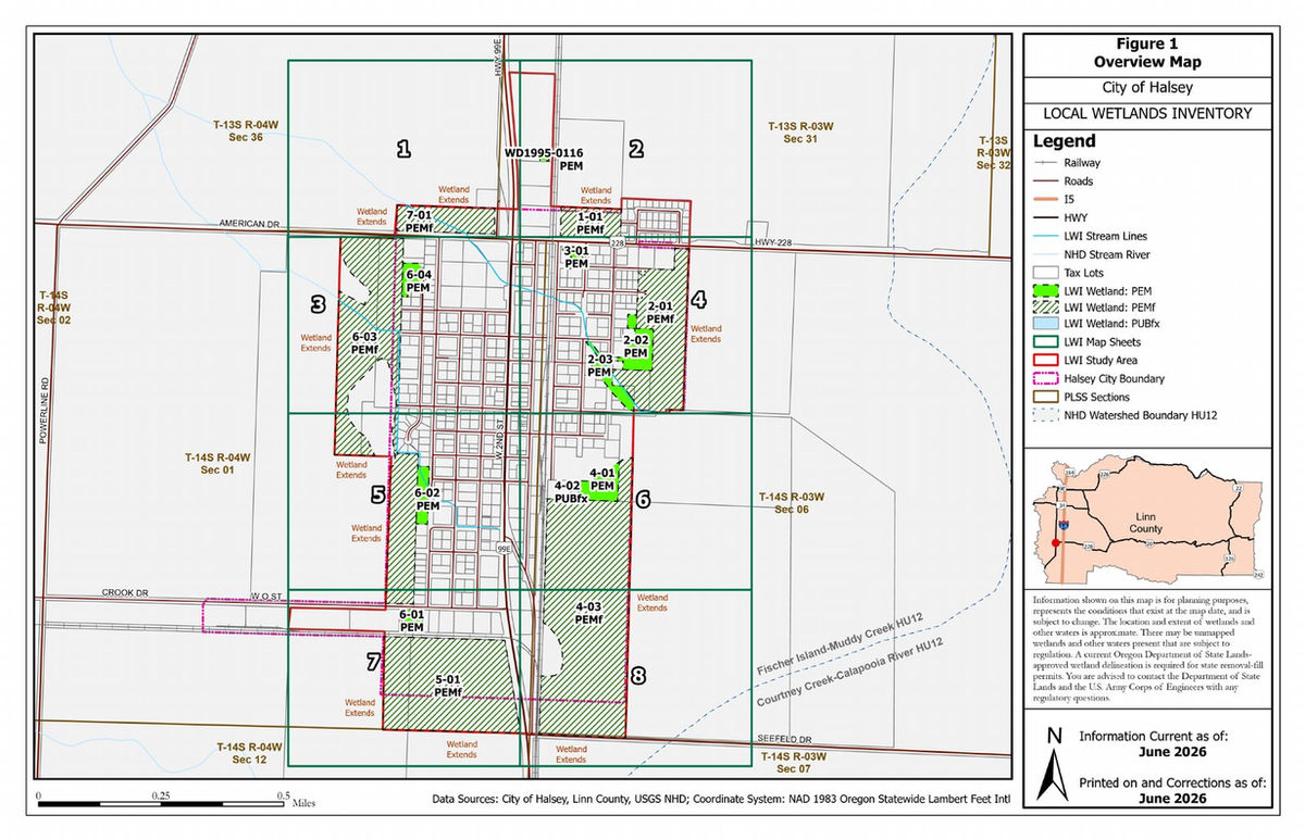
Inventories map and describe wetlands and riparian areas across a study area, giving communities and landowners a basis for planning and protection.
- Local Wetland Inventories (LWI) prepared for Oregon DSL review
- Riparian inventories and assessments
Typical clients: Cities, counties, planning agencies, and landowners.
08
Biological assessments and surveys
Projects with a federal nexus, or sites with sensitive species and habitat, often need biological documentation before they can move forward.
- Biological Assessments
- Essential Fish Habitat consultation
- Wildlife surveys
- Botanical surveys and plant identification
- Habitat assessments
Typical clients: Projects requiring federal consultation, and landowners who need to know what species and habitat are on their site.
